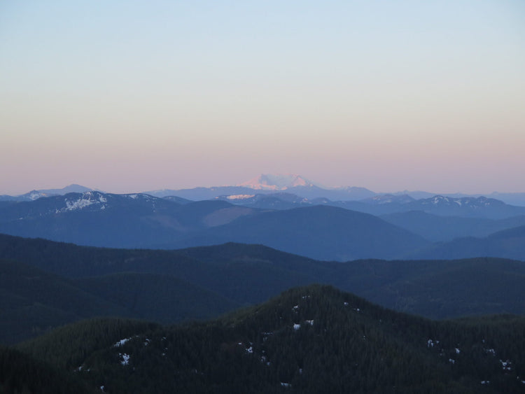
Puyallup Ridge
Pass/Permit: Wilderness Permit (self-issue at trailhead), Northwest Forest Pass for Parking
Length: 9.6 Miles
Elevation: 2300 ft gain, 5465 ft high point
Difficulty: Hard
A long, difficult, and satisfying hike that begins just outside the park.
Description:
Steep inclines, gorgeous lakes, and incredible vistas characterize this hard but satisfying hike just outside Rainier National Park. The trail immediately comes to T, with Glacier View trail going to the left and Paradise Trail (leading to Puyallup Ridge) going right. Remember this T, as it will be the spur that leads you back to the parking lot on your way back, which is not a junction you want to miss! The trail follows a ridge for a bit, then drops into Beljica Meadows (full of beautiful wildflowers in the spring and early summer) but stays well shaded in the trees just above the meadow. Several lakes are spread among the wildflowers. The trail begins to climb and will be joined by the Lake Christine Trail (no. 249) from the right, before cresting a ridge and heading down to Goat Lake at 2.5 miles. From Goat Lake, the trail rises steeply and passes into the national park at 3.0 miles. At this point, per park rules, pets and pack animals are no longer allowed, however, because you are entering the park on foot you do not need to worry about paying an entrance fee. Shortly after entering the park, the trail is joined by the Gobblers Knob side trail, then climbs another 0.4 miles to an old fire lookout with incredible views of Rainier and St. Helens. From Goat lake to Gobblers Knob is only 1.5 miles, but 1100 feet of elevation gain, so get ready for a steep climb!
Directions/ Road Conditions:
From Ashford, drive Hwy 706 east for 3 miles. Keep an eye out for FR-59; if you pass Copper Creek Inn and Restaurant, you’ve gone 0.2 miles too far. At 2.8 miles up FR-59, stick left, and at the 6.9 mile junction, continue straight. At 8.3 miles, the road widens to a trailhead area, and parking is available (however there is no restroom, so be sure to stop in Ashford before you head up!).
Coordinates: 46.7069, -121.9370
Current Conditions:
05/14/2024 - FR-59 is washed out 0.5 miles in by a massive landslide. There are three other landslides further up the road, all passable on foot, but with 8 miles to the trailhead this is no longer a feasible day hike. Alternate route to the trail: Head West on Hwy 706 from Ashford for 0.4 miles. Turn right onto the road leading to the Amphitheater and Play Park, sticking onto the left road that passes the playground. Continue for 5.8 miles, then keep right at the fork. 3.1 miles later, take another sharp right and continue for 3.2 miles before turning right on NF-5942. 4.2 miles later, take one last right turn, and you’ll reach the trailhead. We cannot vouch for the condition of this road, but suggest off-road tires and high clearance vehicles only.


