High Rock
Pass/Permit: None
Length: 3.2 Miles Round Trip
Elevation: 1356 ft gain, 5685 ft high point
Difficulty: Easy/Medium
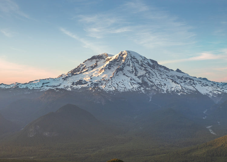
A classic viewpoint of Mount Rainier, with stunning views at sunrise and sunset.
Description
High Rock Lookout dominates its surroundings, providing incredible views of Rainier, St. Helens, and Adams on clear days. The trail begins on the northwest side of the parking area, where the road first widens to form the parking area (ignore the wider trail immediately to the right, it reconnects with the main High Rock trail in 0.1 miles). The trail is well shaded by hemlock and young fir, and huckleberries are abundant along the lower parts. The trail is fairly steep, and lacks switchbacks, climbing to the north-northwest just below Sawtooth Ridge. At 0.7 and 0.9 miles there are wooden benches, which make great resting spots. At 1.3 miles the trail emerges onto the ridgeline and provides a viewpoint, but the trail continues up along the west side of the ridge top, passing below the lookout cabin and up to the edge of northern edge of the ridge, with dizzying drop-offs ahead of you. The trail veers right, then up onto the rock that gives this trail its name. Enjoy the view, but keep kids and dogs close as the drop off the north side of the peak is over 600 feet. Mount Rainier can be seen to the north east, as can Cora Lake (over 1800 feet below you).
Directions/ Road Conditions
From Ashford, drive Hwy 706 east for 2.4 miles. Turn south onto Skate Creek (Kernahan) Road and drive this for about 5 miles. Make another right onto Forest Service Road 84 and continue straight for 6.5 miles. At the fork, keep right, turning onto Road 8440. After another 2.6 miles the road will flatten and widen, providing parking for about a dozen vehicles. There are no bathrooms at the trailhead, so be sure to stop in Ashford before you head up!
Coordinates: 46.6664, -121.8913
Current Conditions:
Popular on weekends (but not national park popular) we recommend getting an early start one this one! Check out WTA and AllTrails for current conditions.


