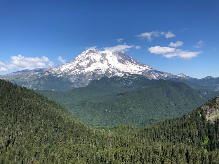
Glacier View
Pass/Permit: Wilderness Permit (self-issue at trailhead)
Length: 4.4 Miles
Elevation: 950 ft gain, 5450 ft high point
Difficulty: Medium
Great views of Rainier, with a possibility of seeing Helens, Adams, and Hood to the south.
Description
You don’t need to wait hours to get into Rainier National Park just to get great views of the peak. Glacier View trail has stunning views of the peak that rival any in the park itself, and significantly fewer people to share them with. Trail No. 267 climbs steeply (650 feet of elevation gain in 0.8 miles) through an old growth forest of hemlock, Douglas fir, and red cedar, with huckleberry and salmonberry, providing ample berry picking opportunities toward the end of summer. Much of the trail is rocky and rooty, so watch your footing and pick up a pair of trekking poles if possible! At the one miles mark, there appears to be a fork leading off to the right, but this is just a quick side trail linking back with the main route, so we suggest you stay on the most well-trodden trail. At 1.9 miles, there is a real fork, with Glacier View Trail no. 267 continuing to the right and down toward Lake West, Saddle Lake, and Lake Helen. However, to get the best views, continue north on the spur toward Glacier View Summit, another 0.3 miles and 300 feet to the peak. If the weather is clear, you should have incredible views of Tahoma’s western face, 9 miles to the east, and if you get truly lucky you may be able to see Adams, Helens, Hood, and Baker on the horizon.
Directions/ Road Conditions
From Ashford, drive Hwy 706 east for 3 miles. Keep an eye out for FR-59; if you pass Copper Creek Inn and Restaurant, you’ve gone 0.2 miles too far. At 2.8 miles up FR-59, stick left, and at the 6.9 mile junction, continue straight. At 8.3 miles, the road widens to a trailhead area, and parking is available (however there is no restroom, so be sure to stop in Ashford before you head up!).
Coordinates: 46.7069, -121.9370
Current Conditions
05/15/2024 - FR-59 is washed out 0.5 miles in by a massive landslide. There are three other landslides further up the road and possibly more beyond that. They are all passable on foot, but it will be an additional 8 miles of hiking on the road to get to the trailhead. There are currently no alternate routes that are shorter than 10 miles one way or 20 miles round trip.
For more info check out WTA and All Trails


