Silver Creek
Pass/Permit: None
Length: 7.8 Miles round trip
Elevation: 1200 ft gain, 4080 ft high point
Difficulty: Medium
A beautiful, dog-friendly hike through old growth forests.
Description
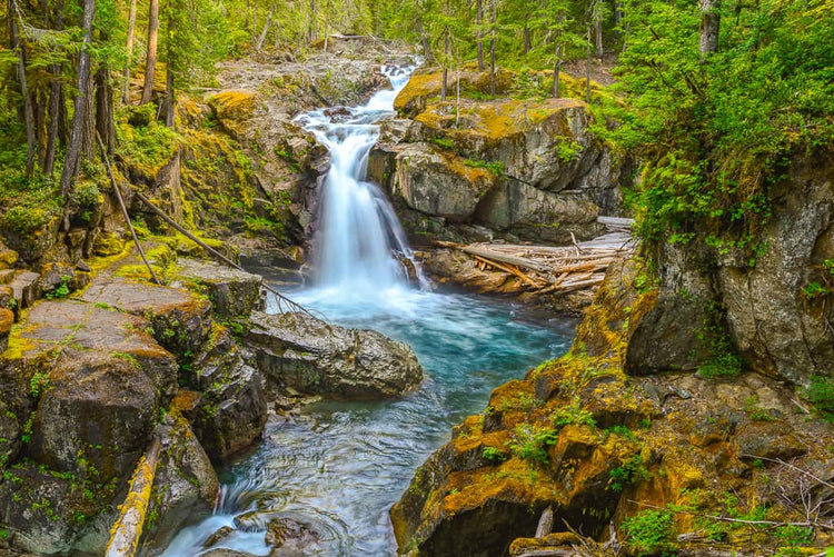
Massive old growth forests, clear streams coated with mossy banks, and dense underbrush will make you feel like you’ve stumbled into a medieval fairytale on this hike. On the drive in, you’ll pass the Bear Prairie ranger station which was built in 1906 and operated until 1947. About a half mile before the trailhead, you’ll come to a wide pullout with ample parking, although you can choose to drive the last 0.5 miles if you choose (be aware that the road becomes much more rutted and low hanging branches may scratch your car). The trail meanders through beautiful coniferous forest, and at about the one mile mark it bisects FR-5222, which you must cross over. The trail then continues uninterrupted for another 3.5 miles, before ending at Forest Road 84. Dogs are allowed, but must be on a leash!
Directions/ Road Conditions
From Ashford, drive Hwy 706 east for 2.4 miles. Turn right onto Skate Creek Road (aka Kernahan road) and follow this for about 11 miles. Then turn right onto FR-2540 (also called Forest Road 134). After 0.5 miles you’ll come to the pullout detailed above. There are no bathrooms at the trailhead, so be sure to stop in Ashford before you head up!
Coordinates: 46.6991, -121.8134
Current Condition
The last 0.5 miles of the road is in bad shape, so we recommend parking at the gravel pullout before it gets overgrown (be aware that this quarry is often used as an impromptu shooting range, so make sure you stay near the road). Check out WTA and AllTrails for current conditions!


